
Most historical objects survive because somebody carefully protected them from change. The Greater Peterborough Master Plan is important for the opposite reason. Its purpose was to change almost everything. Roads, neighbourhoods, workplaces, parks and the city centre were placed on paper before they appeared in the landscape. More than fifty years later, Peterborough still lives inside the decisions drawn into this book.
From expansion study to transformed city
- 1964 Peterborough is identified for substantial expansion as national planners seek new places for population and economic growth.
- 1967 Peterborough is formally designated for New Town expansion on 21 July.
- 1968 Peterborough Development Corporation is established to deliver the expanded city.
- 1969 The emerging plan is placed before the public in a major exhibition and consultation exercise.
- 1970 The Greater Peterborough Master Plan is published by Peterborough Development Corporation.
- 1971 The plan receives ministerial confirmation and large-scale development accelerates.
- 1972 Soke Parkway opens as the new movement system begins appearing on the ground.
- 1974 Major development at Orton begins and a new bridge carries the expanding road system across the Nene.
- 1978 Ferry Meadows opens, realising a major part of the plan’s green Nene Valley vision.
- 1982 Queensgate opens, dramatically reshaping Peterborough’s commercial centre.
- 1988 Peterborough Development Corporation is wound up after two decades of extraordinary physical transformation.
- Today The city’s townships, roads, green spaces and development pattern still reveal the Master Plan everywhere.
The book that became a city
There are maps that describe places. This one helped create one.
The published Greater Peterborough Master Plan runs to more than one hundred pages and includes a folding structure plan.
It looks like a planning document because that is exactly what it is.
Diagrams.
Land-use proposals.
Population forecasts.
Transport networks.
Housing.
Employment.
Landscape.
Shopping.
Community facilities.
But reading it now produces a strange experience.
Again and again, an abstract line on the page becomes something familiar.
Bretton.
Orton.
Werrington.
The Parkways.
Nene Park.
Much of modern Peterborough existed first as an intention in this book.
Explore the complete story through Peterborough New Town: The Plan That Remade the City.
Why did Britain decide Peterborough should become much bigger?
Peterborough was not chosen randomly.
Post-war Britain faced enormous pressure for housing, particularly in London and the South East.
The government’s response included new towns and the planned expansion of selected existing places.
Peterborough offered several advantages.
The East Coast Main Line gave Peterborough exceptionally strong access to the capital.
The city sat beside one of Britain’s most important north-south road corridors.
Engineering, brickmaking, food machinery and other industries already provided a strong employment base.
Large areas around the existing urban edge offered the possibility of expansion at enormous scale.
Crucially, this was not the creation of an entirely separate settlement called New Peterborough.
The old Peterborough was to be expanded.
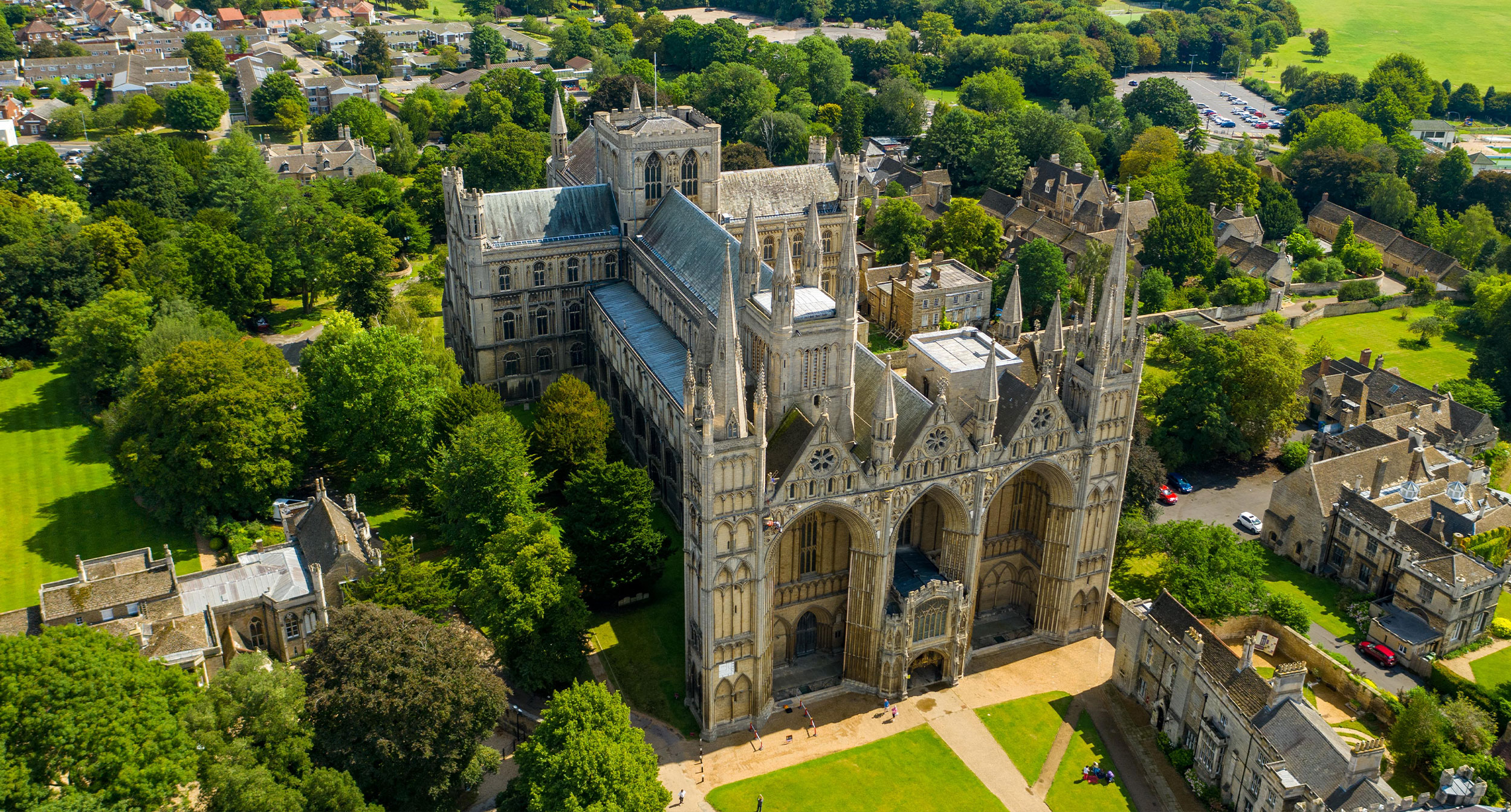
The Cathedral city would remain at the centre.
A much larger modern city would grow around it.
The Master Plan had a prehistory
The 1970 publication did not appear from nowhere.
Peterborough’s expansion had already been under serious investigation for years.
A government expansion study by Henry Wells appeared in 1964.
Architects and planners Hancock Hawkes subsequently developed proposals for the shape of an expanded Peterborough.
Their work explored how large new communities could be arranged around the existing city rather than simply extending conventional suburbia outwards in every direction.
Could Peterborough absorb major population growth?
The physical form of expansion begins to take shape.
Peterborough Development Corporation turns the concept into its programme for a new city.
The Development Corporation inherited these ideas, modified them and transformed them into the plan that would guide actual delivery.
The big idea: do not build one enormous suburb
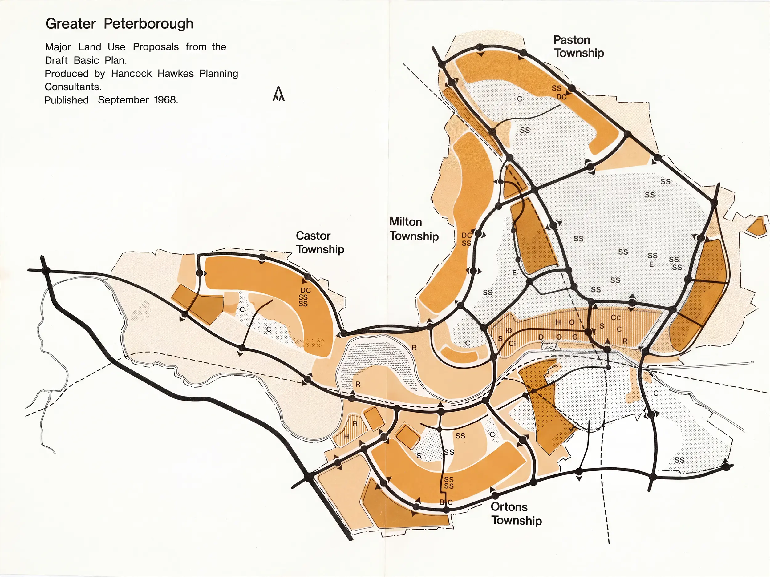
The expanded city was organised around a series of townships.
Each would contain substantial housing, local centres, schools, community facilities and green space.
Employment areas would be distributed around Peterborough but kept close enough to the new communities to remain accessible.
A new road network would bind everything together.
And the River Nene corridor would be protected and developed as a major recreational landscape.
Townships around an existing historic core, joined by major roads and separated by landscape.
That structure still makes Peterborough feel different from many British cities.
Its large neighbourhoods can feel almost like settlements in their own right.
Major roads often run between communities rather than through their local centres.
Green space penetrates unusually far into the urban area.
Bretton, Orton and Werrington moved from plan to reality
The township concept became one of the most visible legacies of the Development Corporation.
One of the first great expansion townships, with extensive housing, employment, schools, shopping and large areas of open space.
A network of neighbourhoods south-west of the old city, closely integrated with woodland, green corridors and the Nene Valley.
Expansion north of the historic village created another large modern township while retaining a distinctive local centre.
A fourth major western township was proposed but never built.
The townships were not intended to be identical.
Landscape, architecture and neighbourhood structure were used to give them different identities.
The Corporation planted thousands of trees and shrubs, creating belts of vegetation that have matured into one of the most successful aspects of the original planning philosophy.
The planners were not simply arranging buildings. They were trying to manufacture neighbourhood identity at the scale of an entire city.
There is also a Peterborough that exists only on plans
Perhaps the most fascinating part of any master plan is what did not happen.
A major township was envisaged west of the city around the Castor and Sutton area.
At one stage it was expected to contain thousands of homes, together with employment land and major infrastructure.
Planned as another major component of Greater Peterborough. Never constructed.
By the time the later stages of the expansion programme were approaching, assumptions had changed.
Household sizes were different from those forecast.
Densities were changing.
Population projections changed.
Government policy changed.
And the intended scale of Peterborough’s expansion was reduced.
Castor therefore provides an important corrective to the idea that master plans simply become reality.
A master plan is not a prophecy. It is an argument about a possible future.
The villages and Nene Valley landscape west of the city can still be explored through The Nene Reaches.
Peterborough was designed around movement
One feature of the New Town era is impossible to miss.
The Parkways.
The Master Plan envisaged a network of fast roads allowing traffic to move around the expanded city without forcing every journey through the historic centre.
A road hierarchy designed for a larger, highly mobile city.
Soke Parkway opened in 1972.
Other sections followed.
Fletton Parkway.
Orton Parkway.
Frank Perkins Parkway.
Major junctions, bridges and dual carriageways created an urban road system unlike the conventional radial streets of the old city.
The system remains one of the clearest ways in which modern Peterborough reveals its New Town origins.
The plan also reserved an enormous space where building would not happen
The River Nene was not treated simply as an obstacle for roads and housing to cross.
The plan envisaged a substantial green recreational corridor along the valley.
This became Nene Park.
The 1971 plan showed parkland extending along the Nene from the A1 towards the city centre.
Gravel extracted to supply the enormous construction programme left behind pits that could be flooded and landscaped.
Ferry Meadows opened in 1978.
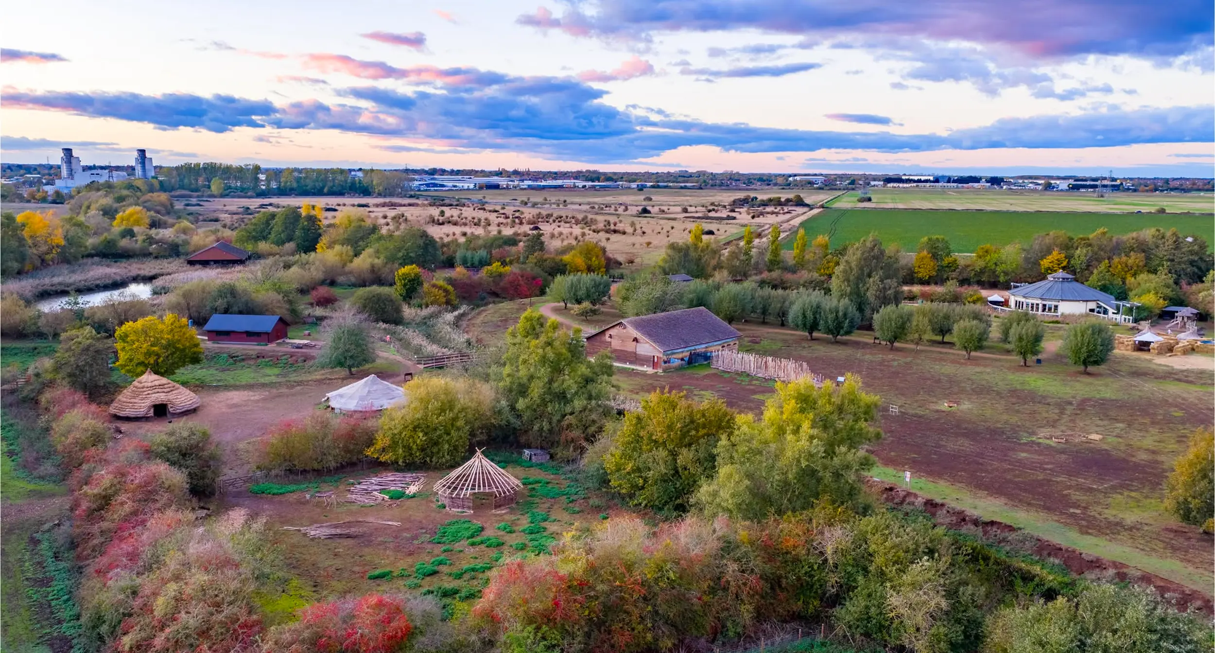
Today, the lakes, meadows, woodland and river corridors of Nene Park are among Peterborough’s most valued recreational landscapes.
One of the great successes of the plan was deciding that the rapidly growing city needed emptiness as urgently as it needed buildings.
The old city centre had to serve a city twice its former size
Expansion could not happen only at the edges.
The historic centre also had to change.
A dramatically larger population would need more shops, more parking, better transport interchange and greater commercial capacity.
But Peterborough presented a difficult planning problem.
The centre already contained the Cathedral, medieval street patterns, Georgian buildings, civic landmarks and established shopping streets.
The Development Corporation therefore had to negotiate between preservation and intervention.
Cathedral, Guildhall, established streets and buildings worth retaining.
A centre capable of serving a substantially larger Peterborough and its wider catchment.
A long process culminating in major projects including Queensgate.
Detailed city-centre planning continued beyond the main Master Plan.
The most dramatic result arrived in 1982 when Queensgate Shopping Centre opened beside the railway station.
It became a new commercial centre of gravity and strengthened Peterborough’s role as a regional shopping destination.
A successful New Town needed jobs, not just houses
The objective was not to create an enormous dormitory settlement for London commuters.
The Development Corporation had to expand Peterborough’s economy at the same time as its population.
Employment areas were therefore integral to the city’s structure.
Peterborough’s existing engineering base provided a foundation.
But the Corporation also actively pursued new employers.
Business parks, industrial estates and office developments expanded the economic geography of the city.
Companies were sold a proposition based on location.
A1 access.
Fast trains to London.
Available land.
A growing workforce.
And a city being deliberately designed for expansion.
The wider industrial context can be explored through Peterborough’s Engineering Story.
Then Peterborough was invited to look at its proposed future
One of the most revealing episodes came before final approval.
In October 1969, the emerging plan was placed on public exhibition.
Public consultation in large-scale planning was still developing as a practice.
Yet thousands of local people came to inspect what was being proposed.
Approximately, according to local historical accounts.
Responses to the proposed future of the city.
The remaining formal objections were heard before confirmation.
The plan was revised before being submitted to government.
Ministerial confirmation finally followed in May 1971.
Whatever later generations think about individual decisions, the process reminds us that people living in the old Peterborough watched the new Peterborough arriving before the first township had been completed.
Then the drawings became roads, houses and trees
Approval transformed the Master Plan from an argument into a construction programme.
A proposed route across a plan.
Machines reshape the landscape.
The line becomes infrastructure.
Eventually nobody remembers that it was once only a proposal.
Ravensthorpe was among the earliest housing developments.
Bretton followed.
Then Orton.
Werrington.
Roads appeared.
Schools opened.
Trees were planted by the thousand.
New companies arrived.
Shopping centres opened.
Residents moved in from London and from elsewhere across Britain.
The pace was extraordinary.
The city was effectively building another city around itself while continuing to function.
But the Master Plan was never followed blindly
Peterborough today is not a perfect physical copy of the 1970 plan.
Nor should we expect it to be.
Planning assumptions changed almost as soon as construction began.
In 1977, the expansion target was reduced.
Economic conditions changed.
Government policy towards New Towns changed.
Housing assumptions changed.
Development Corporation homes increasingly moved into private ownership.
Later development, including Hampton, would eventually push Peterborough into areas and forms not realised by the original Corporation.
This is precisely why the Master Plan is valuable.
It lets us compare the future Peterborough imagined with the Peterborough that actually emerged.
We still live inside the Master Plan
Peterborough Development Corporation disappeared in 1988.
The city it helped create did not.
Drive from the A1 towards the centre and you are using its geography.
Walk beside the lakes at Ferry Meadows and you are using its geography.
Live in Bretton, Orton or Werrington and you are living inside it.
Shop at Queensgate and you are experiencing one consequence of the decision to make the old centre serve a much larger regional city.
The two decades in which the city was physically remade.
LANDSCAPE Nene ParkThe green corridor that became one of the plan’s most loved legacies.
CITY CENTRE QueensgateThe regional shopping centre that transformed the commercial heart.
CONNECTIONS Railway PeterboroughThe transport advantage that helped make expansion possible.
The Development Corporation was wound up in 1988. Its city surrounds us every day.
Why this is a Peterborough object
Many objects in this collection tell us what Peterborough once was.
The Greater Peterborough Master Plan is different.
It tells us what somebody decided Peterborough could become.
That is an extraordinary kind of historical evidence.
A Bronze Age pot records human activity after it happened.
A medieval chronicle records events its writers remembered.
An industrial machine tells us how people made things.
A master plan does something stranger.
It records history before the history exists.
Cathedral city, railway junction and industrial centre.
A proposed future drawn before it existed.
A much larger regional city.
Partly planned, partly altered, continually evolving.
It also helps explain something fundamental about modern Peterborough.
The city sometimes appears to contain two histories.
One is ancient.
The Cathedral.
The medieval streets.
The villages.
The railway and industrial city.
The other feels startlingly recent.
Parkways.
Large townships.
Business parks.
Nene Park.
Queensgate.
They are not competing Peterboroughs.
They are layers of the same place.
Peterborough is an ancient city with a modern city deliberately built around it.
The Greater Peterborough Master Plan is one of the objects that allows us to see the moment those two Peterboroughs were consciously joined together.